Call us:
+31(0)183-712050
Language:
English
English
Nederlands
English
Nederlands
Sign in
shopping_cart
Cart
(0)
Charts
Charts
Passage Charts
Inland
Almanacs
Tides & Currents
Guest Flags
Country Flags
Province Flags
Pilots
Seas
Inland
Books
Books
R.Y.A. / Yachtmaster
Teaching Materials
Navigation
Electronische navigatie
Traditional Navigation
About us
Calendars 2024
search
clear
Home
Charts
Charts
Charts
OK
Filter By
Clear all
Land
Land
Balearic Islands
(4)
Corsica
(3)
Croatia
(8)
France
(4)
Greece
(29)
Italy
(18)
Malta
(1)
Sardinia
(5)
Sicily
(5)
Spain
(12)
Tunisia
(1)
Turkey
(8)
Seas
Seas
Adriatic Sea
(9)
Mediterranean Sea
(12)
N-Atl. Ocean
(14)
North Sea
(13)
Charts
There are 12 products.
Sort by:
Relevance
Sales, highest to lowest
Relevance
Name, A to Z
Name, Z to A
Price, low to high
Price, high to low
Reference, A to Z
Reference, Z to A
Filter
Showing 1-12 of 12 item(s)
Active filters
Land: Croatia
Land: France
Seas: Mediterranean Sea
Quick view
Delius Klasing set 7
€64.90
Quick view
Delius Klasing set 8
€64.90
Quick view
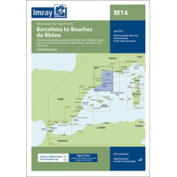
Imray M14 Barcelona to...
€35.50
Quick view
Imray M15 Marseille to San...
€35.50
Quick view
Imray M24 Golfo di Trieste...
€35.50
Quick view
Imray M25 Rab to Sibenik
€35.50
Quick view
Imray M26 Split to Dubrovnik
€35.50
Quick view
imray M27 Dubrovnik to Bar...
€35.50
Quick view
NV.Atlas France FR 9
€64.99
Quick view
NV.Atlas France FR 10
€64.99
Quick view
NV.Atlas Croatia HR 2
€64.99
Quick view
NV.Atlas Croatia HR 1
€64.99
Showing 1-12 of 12 item(s)
Back to top