Edition date 2022
Printed and corrected to October 2022

Secure & quick payment!

Quick delivery with PostNL!
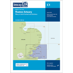
Lowestoft to River Crouch.
A pack of 10 charts for the Suffolk and Essex Coasts. The pack includes:
2000.1 Suffolk and Essex Coasts
1: 120 000 WGS 84
2000.2 Rivers Ore and Alde
1: 35 000 WGS 84
2000.3 River Deben and Orford Haven
1: 35 000 WGS 84
Plans Woodbridge, Tide Mill Yacht Harbour
2000.4 Harwich Approaches and Walton Backwaters
1: 35 000 WGS 84
Plans Walton Yacht Basin and Titchmarsh Marina
2000.5 Rivers Stour and Orwell
1: 35 000 WGS 84
Plans Upper Orwell to Ipswich, Fox’s Marina, Woolverstone Marina, Suffolk Yacht Harbour, Shotley Marina
2000.6 River Blackwater
1: 35 000 WGS 84
Plans Maldon, Tollesbury Marina, Bradwell Marina
2000.7 River Colne
1: 35 000 WGS 84
Plans Wivenhoe, Brightlingsea
2000.8 River Crouch Entrance
1: 35 000 WGS 84
2000.9 Rivers Crouch and Roach
1: 35 000 WGS 84
Plans Fambridge Yacht Haven, Bridgemarsh Marina, Burnham Yacht Harbour, Continuation of River Crouch
2000.10 Orford Ness to Lowestoft
1: 90 000 WGS 84
Plans Lowestoft Approaches, Lowestoft Harbour, Lowestoft Harbour - Lake Lothing, Southwold Harbour
Data sheet
Edition date 2022
Printed and corrected to October 2022