Call us:
+31(0)183-712050
Language:
English
English
Nederlands
English
Nederlands
Sign in
shopping_cart
Cart
(0)
Charts
Charts
Passage Charts
Inland
Almanacs
Tides & Currents
Guest Flags
Country Flags
Province Flags
Pilots
Seas
Inland
Books
Books
R.Y.A. / Yachtmaster
Teaching Materials
Navigation
Electronische navigatie
Traditional Navigation
About us
Calendars 2024
search
clear
Home
Charts
Charts
Charts
OK
Filter By
Clear all
Land
Land
Balearic Islands
(4)
Corsica
(3)
Croatia
(8)
France
(4)
Greece
(29)
Italy
(18)
Malta
(1)
Sardinia
(5)
Sicily
(5)
Spain
(12)
Tunisia
(1)
Turkey
(8)
Seas
Seas
Adriatic Sea
(6)
Baltic Sea
(9)
Gulf of Finland
(4)
Mediterranean Sea
(18)
Charts
There are 18 products.
Sort by:
Price, high to low
Sales, highest to lowest
Relevance
Name, A to Z
Name, Z to A
Price, low to high
Price, high to low
Reference, A to Z
Reference, Z to A
Filter
Showing 1-18 of 18 item(s)
Active filters
Land: Italy
Seas: Mediterranean Sea
Quick view
NV.Atlas Italy IT 2
€64.99
Quick view
NV.Atlas Italy IT 1
€64.99
Quick view
NV.Atlas Italy IT 4
€64.99
Quick view
NV.Atlas Italy IT 3
€64.99
Quick view
Delius Klasing set 7
€64.90
Quick view
Imray M24 Golfo di Trieste...
€35.50
Quick view
Imray M34 Golfo di Venezia
€35.50
Quick view
Imray M33 Adriatic Italy -...
€35.50
Quick view
Imray M32 Adriatic Italy...
€35.50
Quick view
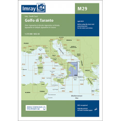
Imray M29 Golfo di Taranto
€35.50
Quick view
Imray M47 Aeolian Islands
€35.50
Quick view
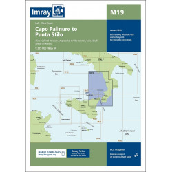
Imray M19 Capo Palinura to...
€35.50
Quick view
Imray M46 Isole Pontine to...
€35.50
Quick view
Imray M18 Capo d'Anzio to...
€35.50
Quick view
Imray M45 Tuscan Archipelago
€35.50
Quick view
Imray M17 North Tuscan...
€35.50
Quick view
Imray M16 Ligurian Sea
€35.50
Quick view
Imray M15 Marseille to San...
€35.50
Showing 1-18 of 18 item(s)
Back to top