


Edition date 2023.
Printed and corrected to Augutus 2023.

Veilig & snel betalen!

Snelle levering met PostNL!
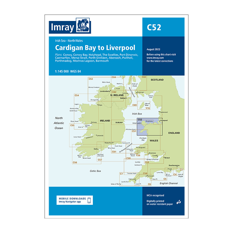
Scale: 1:145 000 WGS84
Imray
Plans included:
Conwy (1:30 000)
Conwy Bay (1:60 000)
Holyhead (1:25 000)
The Swellies (1:15 000)
Port Dinorwic (1:15 000)
Caernarfon (1:15 000)
Menai Strait (1:60 000)
Porth Dinll�en (1:17 500)
Abersoch (1:15 000)
Pwllheli (1:15 000)
Porthmadog (1:10 000)
Mochras Lagoon (1:15 000)
Barmouth (1:30 000)
This edition includes the latest official UKHO data, combined with additional information sourced from Imray''s network to make it ideal for small craft. The chart has been fully revised throughout. The harbour plan of Holyhead has been reschemed to a scale of 1:27 500.
The chart includes charting and tidal data for passage, approach, and mooring, and is designed to be used alongside Cruising Anglesey and adjoining waters by Ralph Morris and the Irish Sea Pilot by David Rainsbury, both published by Imray.
Datasheet
Edition date 2023.
Printed and corrected to Augutus 2023.


