Editie 2026.
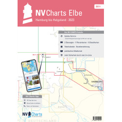
Die Weser, Bremen bis Helgoland & Jade.

Veilig & snel betalen!

Snelle levering met PostNL!
Combination pack paper & digital download incl. App.
2 Passage Charts, 19 Coastal charts & 12 Details/Plans. Format 30x42cm, bound to Atlas. This chart folio contains a download code for all charts in this area / coverage in the digital nv charts format to be used on a smartphone/tablet with the nv chart app. This app is compatible with Apple: iOS/MacOSX, Android, Windows 7/8/10.
• 2 Passage Charts
• 19 Coastal Charts
• 12 Details
• Tidal Calendar and Currents included
• Digital charts & navigation software and nv charts App
• Harbour plans in paper & digital
• Notices for Navigation in German and English language
nv charts for the North Sea - The Charts for the sea area "Weser - Bremen via River Weser to Island of Helgoland & River Jade" are for use by the leisure mariners optimized and professional cartography for the North Sea. All information necessary for the navigation in the challenging waters of the German Bight is provided together with additional harbour plans and details for approaches and passages in these waters. The chart folio also contains tidal data and currents. They are referenced to tidal diamants in the charts.
The atlas format allows a clear structure for navigation. Approaches, ports and anchorage are found fast and easily. All nautical information and important details are available in the charts and in the digital version of the app as well. Tidal data is shown in the software and app. The nv charts cartography is famous for its clever design of the coverages for each chart making best possible use of each scale.
Update
The chart folios for the German North Sea from nv charts are published each year in a fresh and revised edition. For the digital nautical charts a download is provided each spring. Note: up-to-date charts are good seamanship and the base for a safe navigation. NV charts is offering a monthly correction service for charts of the German North Sea from April to October. That way all mariners are always up-to-date.
Passage Charts
C1 Die Weser 1 : 375.000
C2 Ansteuerung von Weser und Elbe 1 : 150.000
Coastal Charts
C3 Ansteuerung von Helgoland 1 : 50.000
C5 Alte & Neue Weser 1 : 50.000
C6 Jade Ansteuerung 1 : 50.000
C7 Tegeler Plate 1 : 50.000
C8 Weser - Elbe - Wattenfahrwasser 1 : 50.000
C9 Mellum bis Jade Weser Port 1 : 35.000
C10 Der Hohe Weg 1 : 35.000
C11 Jadebusen 1 : 35.000
C12 Jadebusen West 1 : 35.000
C13 Robbenplate 1 : 25.000
C14 Langlütjensand 1 : 25.000
C15 Bremerhaven bis Nordenham 1 : 25.000
C17 Nordenham bis Rechtenfleth 1 : 25.000
C18 Brake 1 : 25.000
C19 Elsfleth 1 : 25.000
C20 Vegesack 1 : 25.000
C20A/B Hunte von Huntebrück bis Oldenburg 1 : 50.000
C22A Stephanibrücke bis Hemelingen 1 : 25.000
Details
C4 Helgoland 1 : 12.500
C8A Dove Harle 1 : 25.000
C12A Wilhelmshaven 1 : 15.000
C16 Häfen von Bremerhaven 1 : 12.500
C18A Hafen von Brake 1 : 10.000
C19A Huntemündung 1 : 10.000
C19B Hafen von Elsfleth 1 : 10.000
C20C Hafen von Oldenburg 1 : 20.000
C21 Sportboothfn Hasenbüren bis Überseehafen 1 : 12.500
C21A Vegesacker Kurve 1 : 12.500
C22 Überseehafen bis Stephanibrücke 1 : 12.500
Datasheet
Editie 2026.
Die Weser, Bremen bis Helgoland & Jade.