Editie 2025
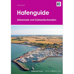
Svenska västkusten södra: Lysekil till Varberg.

Veilig & snel betalen!

Snelle levering met PostNL!
Combination pack paper & digital download incl. App.
2 Passage Charts, 15 Coastal charts & 9 Details/Plans. Format 30x42cm, bound to Atlas. This chart folio contains a download code for all charts in this area / coverage in the digital nv charts format to be used on a smartphone/tablet with the nv chart app. This app is compatible with Apple: iOS/MacOSX, Android, Windows 7/8/10.
• 2 Passage Charts
• 15 Coastal Charts
• 9 Details
• remarkable data also off the beaten tracks
• many own resurveys
• Harbourguide with plans for all marinas and harbours / Hamnlots incl.
• Harbourguide in paper & digital, text in german and swedish language
• digitale charts included
• nv charts app and navigationsoftware
• Navigational notes in german/english/swedish language
nv charts for the baltic - The clever and compact chart folios are a specially designed cartography for the leisure marine market. All charts for the sea area Swedish west coast northern part contain nautical charts in various scales, all harbourplans and the details for approaches and passages. Additional shown are overhead clearances for bridges, powerlines, etc. and all nautical and navigational necessary data.
This chart product for the swedish archipelogo (Skärgård) is due to own surveys and information propably the most detailed chart folio on the market. In many areas, which are of interest to the leisure marine market, larger scale charts are used and additional charts added. A Harbourguide for marinas and natural harbours / anchorages is included. There all boating enthusiasts find nautical important information in German and swedish language. The atlas format allows a clear structure for navigation. Approaches, ports and anchorage are found fast and easily. All nautical information and important details are available in the charts and in the digital version for the app as well. The nv charts cartography is famous for its clever design of the coverages for each chart making best possible use of each scale.
Update
The chart folio NV.Atlas Serie 5.2 for the West-swedish Archipelago from nv charts is published each two years in a fresh and revised edition. For the digital nautical charts a download is provided in spring. Note: up-to-date charts are good seamanship and the base for a safe navigation. Nv charts is offering a monthly correction service for charts of the Baltic Sea from April to October. That way all mariners are always up-to-date.
Datasheet
Editie 2025
Svenska västkusten södra: Lysekil till Varberg.