Editie 2026
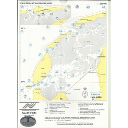
NV-Atlas Nederland 2: Waddenzee.
Papieren kaart met download en App (Apple, Android of Windows)

Veilig & snel betalen!

Snelle levering met PostNL!
Combination pack paper & digital download incl. App.
Format 30x42cm, bound to Atlas. This chart folio contains a download code for all charts in this area / coverage in the digital nv charts format to be used on a smartphone/tablet with the nv chart app. This app is compatible with Apple: iOS/MacOSX, Android, Windows 7/8/10.
• Passage Charts
• Coastal Charts
• Details
• Details and harbour plans
• Digital Charts & Navigationsoftware
• Tidal data with currents and heights incl. in digital charts
• Tidal calendar
• Marina & harbour plans both digital and paper
• Notices for Navigation in German and dutch language
nv charts for the Netherlands - The charts for the sea area of Waddenzee rely on the data from Netherland Hydrographic Office and contain additional marina and harbour plans as well as details for approaches and passages. Bridge heights and opening times are included. The cartography shows the presentation of buoys and marks which is common for the Netherland inland waters. The atlas format allows a clear structure for navigation. Approaches, ports and anchorage are found fast and easily. All nautical information and important details are available in the charts and in the digital version of the app as well. Tidal data is shown in the software and app. The nv charts cartography is famous for its clever design of the coverages for each chart making best possible use of each scale.
Update
The chart folios for the Netherlands from nv charts are published each year an a fresh and revised edition. For the digital nautical charts a download is provided each spring. Note: up-to-date charts are good seamanship and the base for a safe navigation. Nv charts is offering a monthly correction service for charts of the North Sea from April to October. That way all mariners are always up-to-date.
Passage Charts
C1 Borkum · Den Helder 1 : 375.000
Coastal Charts
C2 Texel · Schulpengat 1 : 50.000
C3 Den Helder · Den Oever 1 : 50.000
C4 Texelstroom · Eierlandsche Gat 1 : 50.000
C5 Harlingen · Texelstroom · Makkum 1 : 50.000
C6 Vlieland · Vliestroom 1 : 50.000
C7 West-Terschelling · Harlingen 1 : 50.000
C8 Ameland · Borndiep 1 : 50.000
C9 Ameland 1 : 50.000
C10 Schiermonnikoog · Lauwersoog 1 : 50.000
C11 Schiermonnikoog · Westereems 1 : 50.000
C12 Borkum · Eemshaven 1 : 50.000
Details
C13A Kornwerderzand · Makkum 1 : 20.000
C13B Borkum Haven 1 : 15.000
C13C Den Helder 1 : 15.000
C14A Den Oever 1 : 20.000
C14B Pollendam · Harlingen 1 : 20.000
C14C Nes 1 : 10.000
C14D Harlingen 1 : 15.000
C15A Oost Vlieland 1 : 10.000
C15B Aanloop Oost-Vlieland
C15C Oudeschild 1 : 10.000
C15D West-Terschelling 1 : 10.000
C15E Aanloop West-Terschelling 1 : 30.000
C16A Lauwersmeer 1 : 30.000
C16B Zoukamp 1 : 15.000
C16C Aanloop Schiermonnikoog 1 : 30.000
C16D Schiemonnikoog 1 : 5.000
C16E Lauwersoog 1 : 10.000
Datasheet
Je bent misschien ook geïnteresseerd in
Editie 2026
NV-Atlas Nederland 2: Waddenzee.
Papieren kaart met download en App (Apple, Android of Windows)